
Dictionary, Census of Population, 2016
Standard Geographical Classification (SGC)
Definition
The Standard Geographical Classification (SGC) 2016 is Statistics Canada's main classification of geographic areas in Canada. It is designed to classify statistical information by geographic areas. The classification consists of four levels: geographical regions of Canada, provinces and territories, census divisions (such as counties and regional municipalities) and census subdivisions (such as municipalities). The four geographic levels are hierarchically related; a seven-digit code is used to show this relationship.
The 2016 version of the SGC includes four classification variants:
- Statistical Area Classification – Variant of SGC 2016
This classifies census subdivisions by census metropolitan areas (CMAs), census agglomerations (CAs) and census metropolitan influenced zones (MIZ) including territories in the areas outside CMAs and CAs. - Statistical Area Classification by Province and Territory – Variant of SGC 2016
This classifies census subdivisions by census metropolitan areas (CMAs), census agglomerations (CAs) and census metropolitan influenced zones (MIZ) including territories in the areas outside CMAs and CAs. In this classification variant, these categories are further classified by provinces and territories. - Economic Regions – Variant of SGC 2016
This classifies census subdivisions into census divisions and economic regions. - Agricultural Regions – Variant of SGC 2016
This classifies census subdivisions into census divisions, census consolidated subdivisions and census agricultural regions.
Reported in
2016, 2011, 2006, 2001, 1996, 1991, 1986, 1981, 1976, 1971, 1966, 1961
Remarks
Census subdivisions (CSDs) aggregate to census divisions (CDs), which aggregate to province or territory which, in turn, aggregate to geographical regions of Canada (Figure 1.2).
Figure 1.2
Standard Geographical Classification (SGC) hierarchy
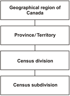
Description of Figure 1.2
Figure 1.2 is a graphical representation of the hierarchy of geographic areas that make up the Standard Geographical Classification (SGC). There are four boxes that are stacked vertically and linked together with lines. The boxes are labelled with the geographic areas that make up the SGC hierarchy. The bottom box is the census subdivision (CSD) level, which is the lowest level in the SGC hierarchy. The CSD (bottom box) aggregates up to the census division (second box), which then aggregates up to the province/territory (third box), which then aggregates up to the highest level in the hierarchy, the geographical region of Canada (top box).
Source: Statistics Canada, 2016 Census of Population.
The hierarchical relationship is reflected in the seven-digit SGC code. For example:
| PR-CD-CSD code | Description |
|---|---|
| 12 06 008 | Province 12: Nova Scotia |
| 35 06 008 | Province 35: Ontario |
Changes to the Standard Geographical Classification for the 2016 Census
This version introduces the new classification variant 'Agricultural Regions – Variant of SGC 2016.' This variant includes census agricultural regions and census consolidated subdivisions, both of which are used by the Census of Agriculture for disseminating agricultural statistics.
Refer to the related definitions of census agricultural region (CAR); census consolidated subdivision (CCS); census division (CD); census metropolitan area (CMA) and census agglomerations (CA); census metropolitan influenced zone (MIZ); census subdivision (CSD); economic region (ER); geographical region of Canada and province or territory. The Standard Geographical Classification is presented in the Standard Geographical Classification (SGC), Volumes I and II, 2016 (Catalogue nos. 12-571-X and 12-572-X).
Changes prior to the current census
In 1976 and 1971, both SGC and census codes were used to disseminate census data.
In 1966 and 1961, only census codes were used to disseminate census data.
- Date modified: