2021 Census – Boundary files
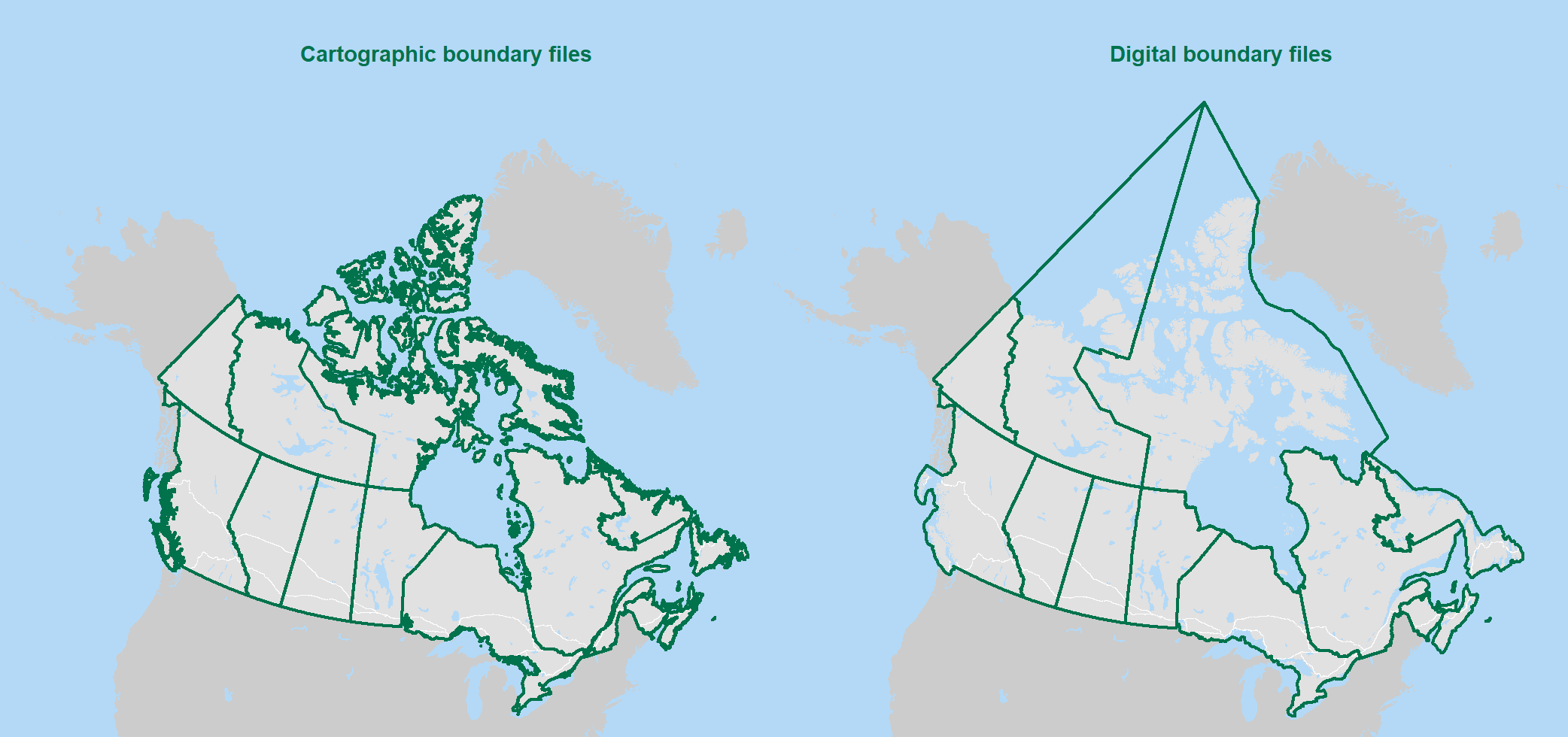
There are two types of boundary files: cartographic and digital. Cartographic boundary files portray the geographic areas using only the major land mass of Canada and its coastal islands. Digital boundary files portray the full extent of the geographic areas, including the coastal water area.
There are also three types of geographic area: administrative, statistical and non-standard. Administrative areas are defined, with a few exceptions, by Canadian federal and provincial/territorial statutes or agencies, and adopted by Statistics Canada for the purpose of data dissemination activities. Examples include: provinces, territories, health regions and federal electoral districts. Statistical areas are defined by Statistics Canada to support census and survey dissemination activities. They are created according to a set of rules based on geographic attributes and one or more characteristics of the resident population. Examples include: populations centres, economic regions and dissemination areas. Non-standard areas are defined by Statistics Canada as areas that are customized aggregations of individual standard geographic areas, and areas that do not match the standard geographic areas at all. Examples include: the population and agricultural ecumenes.
Reference guides are available for download or viewing.
Boundary files options
To download this product, please select from the choices below:
- Date modified:
